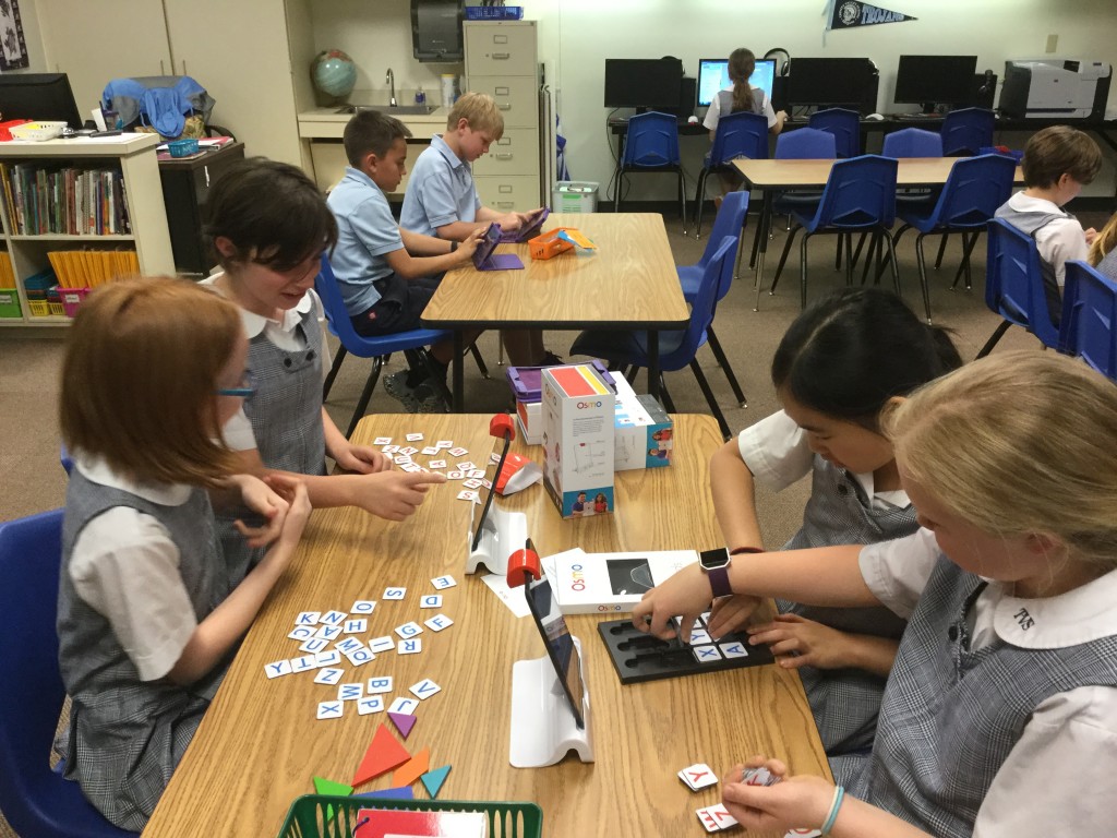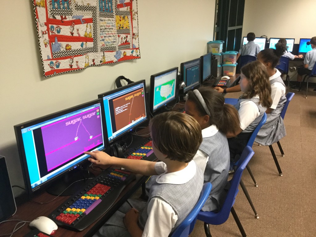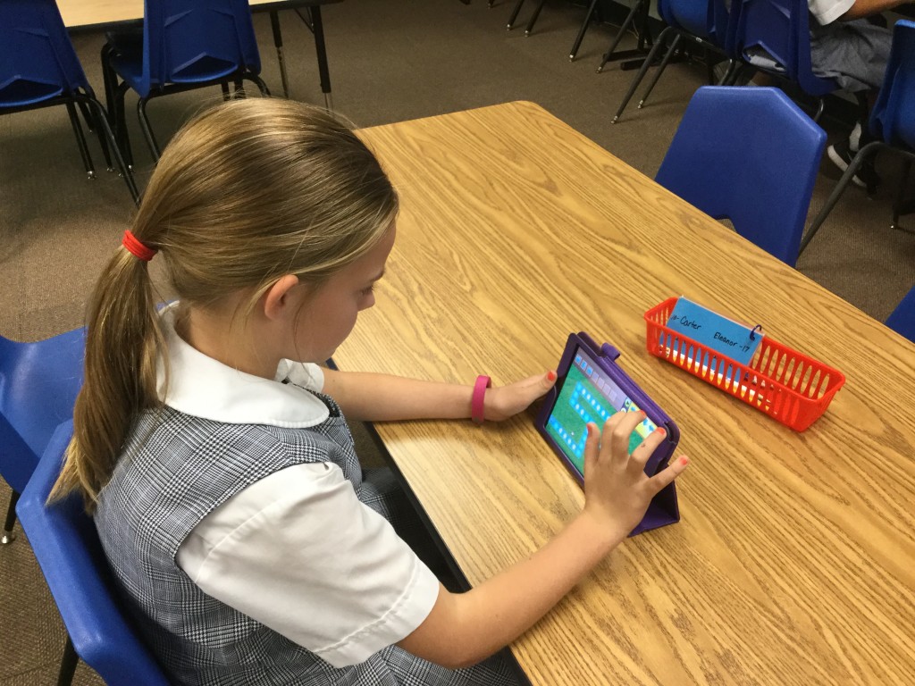
Last week I started something new with the 4th graders – Fantastic Fridays. On the board, I wrote a list of activities. Some were things they’ve done before but never seemed to get tired of it. Others were completely new.
- Osmo – a unique way to physically interact with the iPad
- Ozoblockly – drag and drop programming to use with Ozobots
- Kodable – programming curriculum for elementary students
- Know Your States – an excellent interactive game to learn where the states are located.
- Sugar, Sugar – a fabulous problem-solving activity

The students were SO engaged! Yes, there is a time when you have to teach skills but choosing your learning is critical! We, as teachers, must make time for that as well. Be sure to walk around and listen in on conversations – the dialog, the problem-solving, the planning is amazing!

The girl who was using Ozoblockly even returned after school so that she could show her sister what she’d done in class.
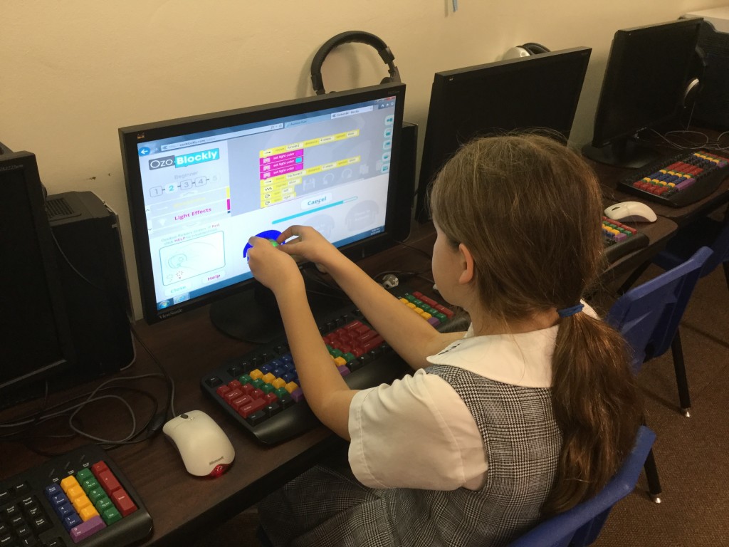
She also wanted me to video her Ozobots dancing in tandem. Here they are:
The last question the students asked as they exited the lab was, “May we please do this again?”
And, yes, we most definitely will!
I wanted to share a website that has been around awhile but it’s one that is an invaluable resource.
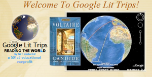
Google Lit Trips, the brainchild of Jerome Burg, combines literature with the power of Google Earth. Imagine being able to “travel” with the character to various settings in the book! As students “stop” in each location, they are able to more deeply discuss the book as they virtually experience the actual locale. They are making connections: text-to-self and text-to-world. Each stop always includes at least one of the following: possible questions to ask, links to related sites, images, video. This is truly a powerful tool to bring literature to life!
The site offers something for every age – from Make Way for Ducklings to Number the Stars to The Grapes of Wrath. Many of the Lit Trips are teacher-made and some have even been created by students.
A few years ago, I worked with Jerome on a lit trip to London. This was based on the book, A Walk in London, by Salvatore Rubbino. Let me just say that Jerome is fantastic to work with – he offers wonderful suggestions and is truly an expert at mapping the trips!
 In January, I was pleased to hear from Jerome again. This time he was thinking about a Texas-themed book because he would be presenting at the Texas Library Association annual conference. The book he decided on was The Armadillo from Amarillo, by Lynne Cherry. I was excited to again be asked to help with this lit trip! At his session at TxLA, Jerome introduced the latest Google Lit Trip:
The Armadillo from Amarillo
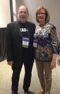
At TxLA, I was able to attend Jerome’s session and then my husband and I had the pleasure of having dinner with Jerome and his wife, Barbara. What a treat to visit and get to know them better! For me, it’s always great fun to meet someone whom I’ve worked with from a distance.
Please give Google Lit Trips a visit. I guarantee that this will be a fantastic way to engage students!
We love having our TCU college students visit our computer lab. It provides extra hands and more individualized attention for the little ones! Last week, in conjunction with the first grade studies of basic facts and geography, we introduced the Math Ahoy! app to the students.
Math Ahoy! is a fun app that promotes problem-solving and addition skills as students travel the world in a pirate’s ship, collecting treasure chests of gold! What child wouldn’t enjoy becoming a pirate for the day? Below is the trailer introducing the app.
On Wednesday, in addition to 21 first graders in the lab, we had 8 TCU students and two other adults observing the class! Quite a full house! But the college students joined the little ones on the floor and guided them through the app’s instructions. There was constructive chatter as everyone talked about which direction to travel in order to avoid the King’s Ships and to gather the gold. I loved hearing children announce that they had reached Africa or South America; the app helps with geography too!
Math Ahoy with 1st Graders from Trinity Valley School on Vimeo.
The students gave the app a hearty thumbs up and their teachers loved the thinking that occurred throughout the game!
I’m a week late in posting this but wanted to share the incredible experience we had at the Library of Congress Geography and Map Room while attending the Google Geo Teachers Institute. We spent two hours behind the scenes at the Madison Building learning about and viewing incredible maps, many created hundreds of years ago.


We saw the 1507 Waldseemüller map which is the first map known to use “America” as a label for the new lands. This was based on Amerigo Vespucci’s voyages of 1501-1502 to the New World. The map was produced in 12 sheets and it represents a thin North and South America separated from Asia by the Pacific Ocean. Of the 1,000 printed, this one is the only known copy to survive.

I wish I’d taken notes on all the maps we looked at because my memory has failed me but I was so interested in the historical significance that I didn’t catch the names of everything we saw. We were shown several maps drawn by George Washington, including one of Mount Vernon that he drew in 1766.

Another map depicted a civil war drawing of landowners near Washington, DC. It was labeled to show Union and Confederate sympathizers so that Union troops would know who to see to seek food and fresh horses. Another map showed Appomattox on the day the South surrendered to Union troops.
One of the 3-dimensional maps was created to help World War II soldiers know what to expect during the D-Day Landings.

This was a fabulous, behind-the-scenes tour! I’m so glad we had this opportunity.